Your Guide To Hiking Trails In Happy Valley
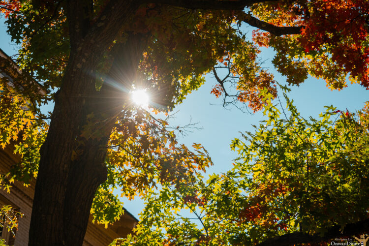
With warmer weather rolling into Happy Valley, there’s no better time to get outside and explore the scenic hiking trails surrounding State College.
Whether you’re looking for a challenging climb or a relaxing walk, the area offers a variety of options for hikers of all experience levels. So here are some of the top spots to check out.
Mount Nittany Loop
Located in Spring Creek Park, this popular trail features 4.7 miles of rocky terrain and an elevation gain of up to 925 feet. Hikers can expect to spend anywhere between two and a half to three hours completing the loop, and for those looking to soak in the views a little longer, an additional 1.2-mile trek leads to the Mike Lynch Overlook.
Millbrook Marsh To Spring Creek Park Loop
This calm, scenic trail is located in the Millbrook Marsh Nature Center, just 2 miles from campus. The 2-mile trail is mostly level terrain, making it great for walking or running. It typically takes between 30 minutes and an hour to complete, making it a perfect option for beginners.
Musser Gap Short Loop
This trail offers a mix of open meadows and wooded areas across its 3.2-mile path. With an elevation gain of 721 feet, the moderately easy hike takes between an hour and a half and two hours to complete. Its varied landscape makes for a fun hike of exploration.
Walnut, Streamside, Poleline, & Woodlot Loop
This 2.1-mile trail in Walnut Spring Park features relatively level terrain and is clearly marked, making it accessible for any hiker. The route takes around 45 minutes and is well-known for its diverse wildlife, giving you plenty of chances to take in Mother Nature.
Rothrock State Forest
In addition to the Musser Gap Short Loop, here are five other trails in Rothrock State Forest worthy of checking out:
The Lower Trail to Charcoal Flats Trail is a 3.2-mile hike that follows along a peaceful creek.
The Lower Trail to Bald Knob Ridge Trail stretches 6.3 miles and rewards hikers with a beautiful mountain view at the top of the ridge.
The Bald Knob Ridge Trail is more strenuous, spanning 7.4 miles and revealing scenic ridgelines and valleys.
The Blue-White, Lone Pine, Deer, and Downer Trail loop covers 3.7 miles and is known for its bird-watching opportunities.
Lastly, the Lower Trail to Charcoal Flats Trail is a 3.2-mile trail submerged in the forest.
Your ad blocker is on.
Please choose an option below.
Purchase a Subscription!
About the Author

Penn State 1996 Campus Shooter Denied Parole After 30 Years
Jillian Robbins maximum sentence ends in 2056.

Former Penn State Football Defensive Lineman Jordan Hill Named Director Of Penn State Football Letterman’s Club
Hill will take over for Wally Richardson, who held the title for 13 years.

Penn State Hoops Building Chemistry In Hopes Of Better Season
Penn State lost 10 players from the 2025-26 season and will rely on a lot of new faces.

10 Questions With The Lush Life Dancer At Movin’ On Sean Eden
“Everyone around was singing and dancing during the concert; the vibes were definitely there!”